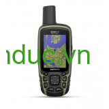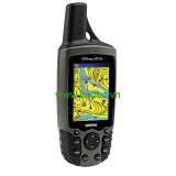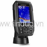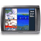
The GPSMAP 421 is a compact chartplotter that features an ultra-bright 4" (10.16 cm) QVGA color display along with an improved high-speed digital design for increased map drawing and panning speeds. It’s ready to go with a built-in, satellite-enhanced worldwide basemap and an easy-to-use interface designed to help you navigate the open waters with ease. The GPSMAP 421 also accepts BlueChart® g2 Vision® cards (sold separately) for added features and functionality such as high-resolution satellite imagery, 3-D views and Auto Guidance technology.
View Satellite-enhanced Worldwide Basemap
The GPSMAP 421 basemap contains worldwide satellite images in place of traditional maps. The GPSMAP 421 also comes standard with a high-sensitivity GPS receiver for superior satellite tracking and quicker acquisition times. In addition, the GPSMAP 421 can receive U.S. graphical weather data via optional GXM™ 51 satellite receiver/antenna. And with an SD™ card slot, it’s easy to add additional maps without connecting to a computer.
Add Extras with BlueChart g2 Vision
With the optional BlueChart g2 Vision SD card, you can add a whole new dimension of exceptional features to your chartplotter.
- MarinerEye view and FishEye view provide you a 3-D perspective of map information, both above and below the waterline.
- High-resolution satellite images and aerial photographs help you orient yourself in unfamiliar areas.
- Auto Guidance technology searches through all relevant charts to create a route you can actually follow — one that avoids obstacles, shallow water, buoys and other obstructions.
Physical & Performance
|
|
Unit dimensions, WxHxD
|
5.7" x 5.0" x 2.7" (14.5 x 12.7 x 6.9 cm)
|
|
Display size, WxH
|
2.4" x 3.2"; 4.0" diagonal
(6.1 x 8.1 cm; 10.2 cm diagonal)
|
|
Display resolution, WxH
|
240 x 320 pixels
|
|
Display type
|
QVGA display
|
|
Weight
|
1.3 lbs (590 g)
|
|
Water rating
|
IPX7
|
|
Receiver
|
High sensitivity
|
|
Antenna
|
Internal with external connection
|
|
Mounting options
|
Bail with swivel or flush
|
|
Power consumption
|
Max power usage at 13.8 Vdc: 15 W
Typical current draw at 12 Vdc: 0.5 A
|
Maps & Memory
|
|
Preloaded maps
|
None
|
|
Accepts data cards
|
1 SD™ card
|
|
Waypoints
|
3,000
|
|
Routes
|
100
|
|
Track log
|
10,000 points; 50 saved tracks
|
Features & Benefits
|
|
Garmin Radar compatible
|
No
|
|
Garmin Sonar compatible
|
No
|
|
NMEA 2000® compatible
|
Yes
|
|
NMEA 0183 compatible
|
Yes
|
|
Garmin Marine Network™ compatible
|
No
|
|
Garmin SmartMode compatible (customizable monitor presets)
|
No
|
|
Supports AIS (tracks target ships position)
|
Yes
|
|
Supports DSC (displays position data from DSC-capable VHF radio)
|
Yes
|
|
Tide tables
|
Yes
|
|
Garmin Meteor Audio System compatible
|
No
|
|
Supports Fusion Lync compatible marine radios
|
No
|
|
GSD™ Black Box sonar support
|
No
|
|
GCV™ Black Box sonar support
|
No
|
|
SiriusXM™ Weather & Radio compatible
|
Yes
|
|
BlueChart® Mobile (planning) compatible
|
No
|
|
Garmin Helm compatible
|
No
|
|
GRID™ (Garmin Remote Input Device) compatible
|
No
|
|
Wireless remote compatible
|
No
|
|
Wireless mouse compatible
|
No
|
Sonar Features & Specifications
|
|
Dual-frequency (50/200 kHz) sonar capable
|
No
|
|
Dual-beam (77/200 kHz) sonar capable
|
No
|
|
CHIRP sonar technology
|
No
|
|
DownVü™
|
No
|
|
SideVü™
|
No
|
|
Voltage range
|
10-32 Vdc input
|
Connections
|
|
NMEA 0183 input ports
|
2
|
|
NMEA 0183 output ports
|
2
|
|
Video input ports
|
None
|
|
Video output ports
|
None
|
|
Wireless connectivity
|
No
|
|
Garmin Marine Network™ ports
|
None
|
- GPSMAP 421
- Tilt/swivel mount
- Protective front cover
- Power/data cable
- Documentation


